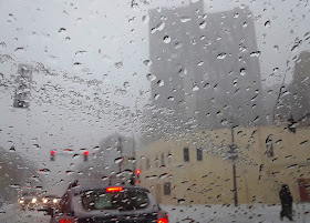
Yes, my drive home from work this afternoon was quite challenging. Thankfully, I was able to leave early and so avoided the worst of today’s “epic” blizzard, as it’s being described by MPR News’ meteorologist Paul Huttner.
Following are more pics from the season’s first winter blizzard as well as an excerpt from Huttner’s latest news report.
A major blizzard continues to rage overnight for much of Minnesota. Blizzard warnings continue until 6 a.m. Thursday for most of Minnesota. As of this post [12/23/20, 7:36 p.m.] I’m seeing reports of many stranded motorists. The Minnesota State Patrol reports cars blocking Highway 12 in southwest Minnesota, with people being rescued from vehicles. Roads are closed by blowing and drifting snow across most of southwest Minnesota. The Duluth area is getting hammered by high winds and snow. Roads are closed at many other locations in Minnesota.
Gov. Tim Walz on Wednesday evening ordered the Minnesota National Guard to provide assistance and emergency relief services for stranded motorists during the winter storm. The Guard has been activated in Renville and Martin counties, and has opened its armories in Olivia and Fairmont to be used as a temporary shelter.
Wind gusts as high as 70 mph have been recorded near Lake Benton, Minn., Wednesday. Many Minnesota locations report wind gusts between 50 and 66 mph.
The heaviest snow zone set up from near Mankato, through the Twin Cities to Duluth and the North Shore. Snow will gradually tamper off from west to east overnight into early Thursday morning.
One amazing facet of this blizzard is that the high winds have literally scoured off snow and left nearly bare ground in open areas. Here are some early snowfall reports as of 6 p.m. Snow is still in progress across eastern Minnesota.
• Minneapolis-St. Paul International Airport: 4.2 inches
• Chanhassen, Minn.: 5.5 inches
• Carver, Minn.: 7.5 inches
The Twin Cities National Weather Service office points out that measuring snowfall in this type of storm is very difficult. Much of it is airborne or deposited in snow drifts.
Bitterly cold air behind the storm is dropping wind chills into the minus 20s to nearly minus 30 in northwest Minnesota. Highs on Christmas Eve will hover in the single digits above zero.
– Paul Huttner
Excerpted from “Epic Blizzard Rages:
70 mph Winds, Blocked Highways, Vehicle Rescues” Minnesota Public Radio News
December 23, 2020
Excerpted from “Epic Blizzard Rages:
70 mph Winds, Blocked Highways, Vehicle Rescues” Minnesota Public Radio News
December 23, 2020
See also the previous Wild Reed posts:
• Autumn Snowburst
• After the Season’s First Snowstorm, a Walk Through the Neighborhood (2019)
• Just in Time for Winter
• Winter of Content
• Winter Arrives! (2009)
• First Snowfall (2010)
• Winter Storm (2012)
• A Winter Walk Along Minnehaha Creek (2013)
• Winter’s Return (2014)
• Winter Storm (2016)
• Winter Beauty (2017)
• Winter . . . Within and Beyond (2017)
• December’s Snowy Start (2018)
• Winter . . . Within and Beyond (2019)
Images: Michael J. Bayly.


No comments:
Post a Comment