

It's the second part of my sharing of photos from a trip I made in June with my friend Kathleen to Grand Marais, a town on Minnesota's beautiful North Shore of Lake Superior.
For Part I, click here.

Above and below: Views of Grand Marais.


Right: The Shoreline Inn, our lodgings in Grand Marais.

Above: If I look rather pensive and perturbed in this photo taken on Friday, June 16, it's because I was. Kathleen and I had just heard that, back in the Twin Cities, police officer Jeronimo Yanez had been found not guilty in the shooting death of Philando Castile.


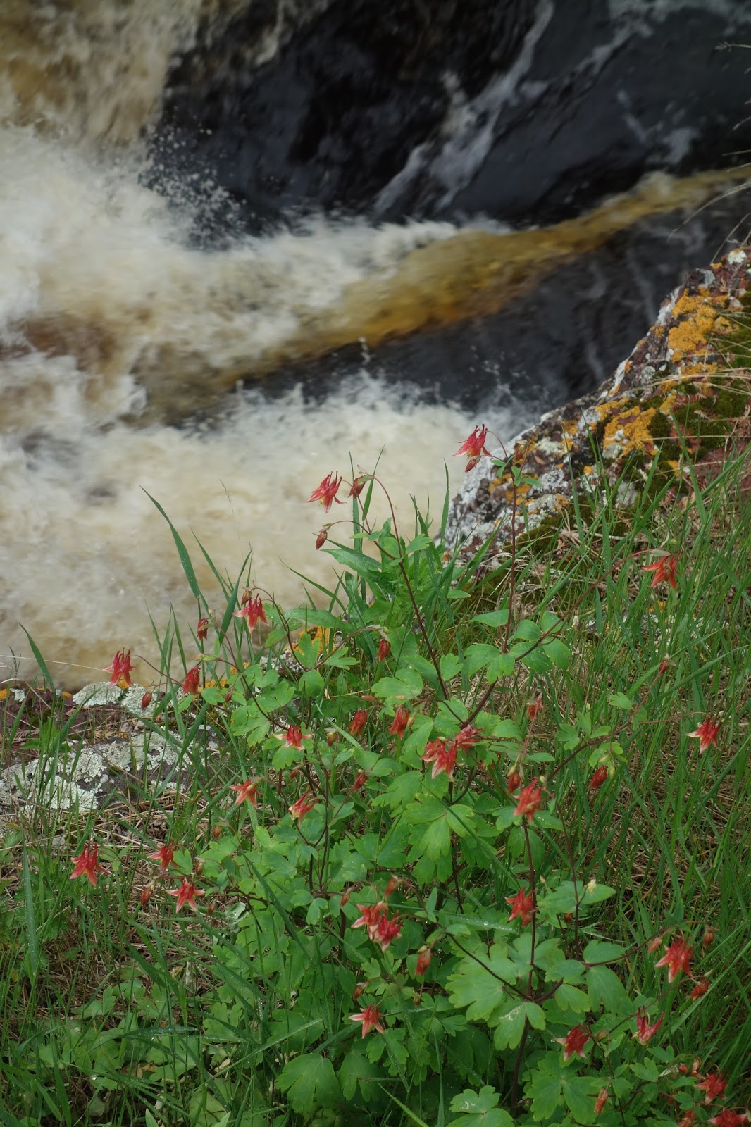
Above: The Temperance River – Saturday, June 17, 2017.

Notes Wikipedia:
The Temperance River was named Kawimbash by the Ojibwa, meaning "deep hollow river." While it retained this name in the earliest geological surveys, in 1864 Thomas Clark reported its present name, which he alleged arose as a pun from the fact that the river has no sand bar near its mouth. However, this is not the only river on Lake Superior to have this feature, which has cast some doubt on that story.
The Temperance River flows 39 miles (63 km) between its source, Brule Lake, and its mouth. Brule Lake is unusual in that it has two outlets. The Temperance flows from its western outlet, and carries approximately half of the flow leaving the lake, while the South Brule River carries the other half from its eastern outlet.
After leaving Brule Lake, the Temperance flows through a chain of smaller lakes for the upper half of its length. It shares this feature with its neighbors, the Cross, Poplar, and Cascade rivers, which gives it a warmer water temperature and more steady flow than streams further to the south. After this, it proceeds to flow directly over the bedrock which is entirely igneous, formed during the formation of the Keweenawan Rift. Near Lake Superior, the river has dug deep potholes into the bedrock, some of which connected to form a narrow gorge and a system of waterfalls. The depth of the water where the river enters the lake prevents the river from developing a sand bar at its mouth. The Temperance has a drainage basin of 198 square miles (510 km2), which is the fourth largest catchment for a Minnesota river entering into Superior, after the Saint Louis River, Pigeon River, and Brule River.


Above: Kathleen with our mutual friend Judy at Crazy Mary's Cafe in Finlayson, MN. We had dinner here on our way back to the Twin Cities on Saturday night, June 17.
See also the previous Wild Reed posts:
• A Visit to Grand Marais (Part I)
• Days of Summer on the Bayfield Peninsula (2013)
• Sunday in Duluth (2010)
• Trempealeau (2009)
• Northwoods (2008)
Images: Michael J. Bayly.


No comments:
Post a Comment